
By Ann Frechette, Co-President Emerita, Friends of Hall’s Pond
This wonderful article is published in the Fall/Winter issue of PLACE, the Brookline GreenSpace Alliance‘s magazine. The Brookline GreenSpace Alliance is a member of the MMOC.
Descriptions of the various green spaces in Brookline often use the term “natural” in their characterizations. Brookline’s official town website describes Hall’s Pond, for example, as “one of only two natural ponds remaining in Brookline” and also notes, “While most of the land and water within the sanctuary have been left in a natural state, there is a formal garden that was planted shortly after the turn of the century and cultivated ever since.” However, the use of the term “natural’ misleads people into thinking that our green spaces are pristine, untouched, primordial or at least preindustrial. That characterization masks the considerable capital investment and on-going labor necessary to sustain our green spaces. I look at water infrastructure in the establishment of the Hall’s Pond Sanctuary as a glimpse into the effort expended over decades to cultivate the illusion of nature.
Hall’s Pond did not start out as the one-acre pond that it is today. Prior to European settlement, it was part of a massive Atlantic White Cedar swamp that extended across much of northeast Brookline. The area was subjected to tidal flooding twice daily as seawater washed up the Charles River. It was referred to in early letters and maps simply as “the marshes.” As European Colonists migrated into the area, primarily to escape overcrowded Boston, they harvested the Atlantic White Cedars, highly valued for their rot-resistant wood, and made them into shingles, fences, boats, barrels, storage chests and other goods. Two major water infrastructure projects then fundamentally changed the landscape.
The first was the Back Bay Mill Dam, constructed from 1818–1821, which was intended to use the differential between the high and low tides of the Charles River to generate power. While the power-generation project failed, one result of the endeavor was a land bridge, now called Beacon Street, that connected Boston to Brookline, previously accessible only via present-day Route 9. Real estate values throughout Northeast Brookline skyrocketed and a housing development boom began.
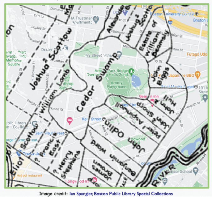
The size of the original Cedar Swamp in 1640, overlaid on a modern street grid.
The second major water infrastructure project was the Charles River Dam, completed in 1910, which ended the tidal flooding. Water in the Charles River was thereafter maintained at a constant fixed level and northeast Brookline became even more attractive for real estate developers. Marshland was filled by leveling hills. Roads, houses, water mains, and sewers were constructed.
What is now called Hall’s Pond shrunk to approximately one acre in size. It was replenished not by Charles River tidal floods, as previously, but by road run-off from throughout North Brookline. Heavy rainfall resulted in regular flooding that also covered present-day Amory Playground, which had been purchased by the town in 1903 and filled repeatedly with landfill to keep the playing fields above the water table.
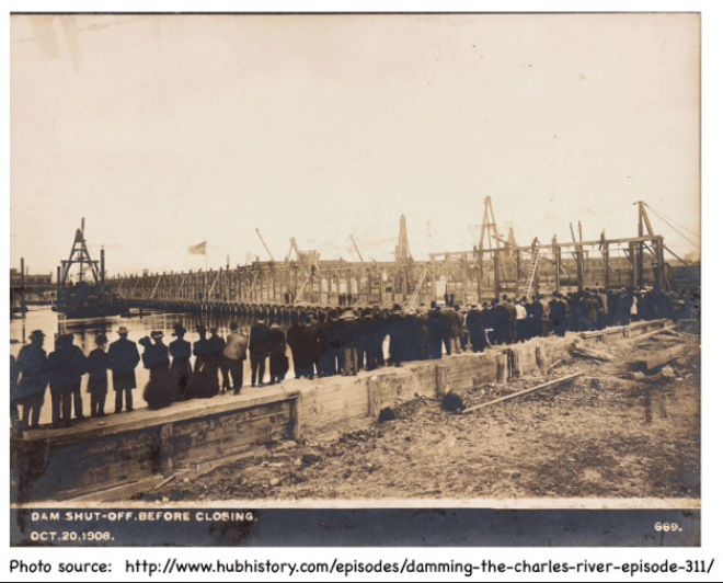
Damming the Charles.
The town invested considerably in water infrastructure to keep Amory Playground in use. In 1916, a sewer and surface water drain was installed over the Freeman Street Extension to Commonwealth Avenue. In 1948, a drainage system was installed throughout the 110-acre watershed to direct run-off into Hall’s Pond essentially transforming it into a water filtration site. A dam was also installed in Hall’s Pond in 1948 to prevent flooding into the playground. The dam was insufficient, so in 1956, an overflow weir was added.
The 1974–1977 town purchase of Hall’s Pond and Amory Woods led to additional projects, including adding marshland between Amory Playground and Hall’s Pond; relocating the outlet pipe for the drainage system; combining Hall’s Pond with Amory Woods; and building a boardwalk around the pond. The water infrastructure projects fundamentally changed Hall’s Pond and the surrounding land.
The quality of the water in Hall’s Pond, as a result of the changes, has been an on-going concern. With the lowest elevation in Northeast Brookline, Hall’s Pond has been infiltrated by run-off from every construction project, roadway and private property in the watershed. It also served as an official town garbage dump for decades in the early 1900s. Mosquito-eradication projects in the 1920s led to the introduction of non-native carp into the pond which have thrived to the present day. A water quality study conducted in 1986 led to recommendations for many improvements including native plantings and removal of invasives.
In 2007, additional water quality concerns led the town to install a solar-powered aeration system in the pond that sends bubbles up through the water column at night to prevent the formation of bacterial mats. There have been multiple calls to DPW about suspected monster-type creatures in the pond when power outages disrupt the timer on the system.
The many decades of infrastructure investments continued in 2025–2026 with the restoration of the boardwalks around the pond and in Amory Woods and with new drainage and plantings to control run-off from the parking lot. On-going projects include planting native plants, removing invasive species and removing garbage left daily in the pond sanctuary. The capital and human labor investments have been tremendous. While it is nice to think of the pond as “natural,” its naturalness is, in fact, a massive and ongoing human undertaking to cultivate a place of respite from the even more unnatural surrounding landscape that is urban North Brookline.
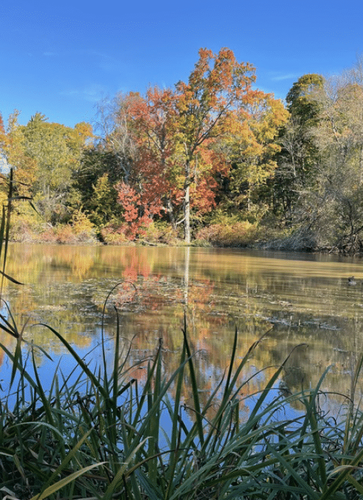
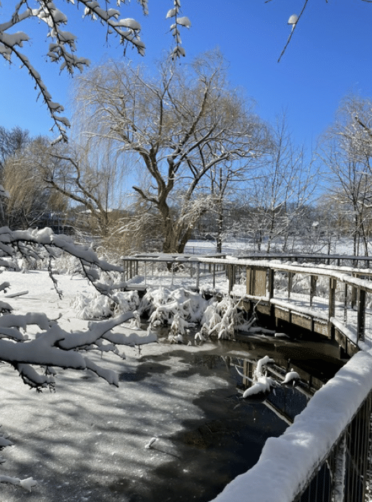
See the article in full in the Fall/Winter issue of PLACE.
Photos of Hall’s Pond in the fall and winter: John Shreffler
Top image: The watershed that feeds Hall’s Pond.