US Army Corps Report – Muddy River Flood Risk Management & Environmental Restoration Project Phase 1 Construction Activities Next 90 Days
A lot has happened since the last update in mid March! Spring (and even some summer temps!) have finally descended on Boston, and Brookline Avenue has been opened back up to two-way traffic! There was a two day traffic shift on 25 and 26 April so that the construction of the second half of the new Riverway culvert could continue and so that construction of the new left turn from Riverway onto Park Drive could begin. In the upcoming months, the remaining precast concrete culvert sections will be installed. When that work is complete, daylighting of the Muddy River will begin late Summer.
In the Upper Fens Pond work area, the river diversion pumps were turned on mid-April. This enabled us to dewater the Upper Fens Pond between the sheet pile cofferdams that were installed near the Jug Handle roadway and downstream of Avenue Louis Pasteur. Excavation of the river sediment began late April so that we can start construction of the flood control channel in the river and restore/stabilize the banks of the Upper Fens Pond. These activities will continue into the Fall.
Thank you for your continued interest and support for this project!
General: The Muddy River Flood Risk Management & Environmental Restoration Phase 1 Construction Project is located in the footprint generally between the Riverway downstream to Avenue Louis Pasteur. The major project components involve the installation of a 10-foot by 24-foot box culvert under the Riverway roadway, the installation of 10-foot by 24-foot box culvert under the Brookline Avenue roadway, daylighting of the area between the Riverway and Brookline Avenue, and daylighting of the area between Brookline Avenue and Avenue Louis Pasteur. Daylighting is the removal of existing twin 72″ culverts and excavation of the area to return the waterway to a natural state. This Notice is intended to identify the general construction activities that will be performed in the next 90 days. A figure that shows the existing conditions and the proposed improvements is at the end of this report.
May 2015 through July 2015 Period:
-
In order to continue the work on the Riverway Culvert, a traffic shift was performed on April 25 and 26, 2015. This traffic shift maintained the current traffic pattern around the former Sears Parking Lot at Park Drive, between the Landmark Center and the Riverway Connector, but funneled the three lanes of traffic down to two lanes as it rounds the former Sears Parking Lot and connects with the Riverway Connector. In addition, Brookline Avenue was opened back up to two-way traffic to alleviate any potential congestion caused by the Park Drive lane reductions. The current traffic pattern can be seen in the figure shown below.
-
In the Riverway Culvert work area, since the traffic move, the contractor has removed the pavement from the existing roadway in the area of the new culvert location. Steel sheeting for the support of excavation will be installed; excavation to grade to top of footing; and installation of steel pipe piles will take place in next two months. Then concrete placement for pile caps; wingwall; and invert slab will be done prior to the precast concrete culvert installation. Culverts could potentially be installed late July.
-
Over the next couple of months, in the area around the former Sears Parking Lot (Riverway Island, Landmark Center Island, near Brookline Avenue), we will installing conduits and foundations for the end condition roadway lighting, which may result in occasional lane closures.
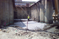
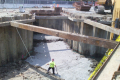
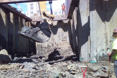
- A concurrent activity to the Riverway culvert and end condition roadway lighting work is the sediment removal and bank restoration/stabilization of the Upper Fens Pond. The diversion efforts (installing pumps; sheeting; piping; etc.) started in January and active diversion of the river began in mid-April. The diversion of the river flow from upstream of the cofferdam near the Jug Handle roadway through the diversion piping that discharges the flow back to the river just downstream of the cofferdam near Avenue Louis Pasteur provided a work area in which the sediment is dewatered so that it can be transported off-site. The removal of the sediment in the river bottom leads to the construction of the new flood control channel through and bank stabilization/restoration of the Upper Fens Pond. In addition, the section of culvert between the Upper Fens Pond and Avenue Louis Pasteur will be removed and the river “daylighted” to continue the flood control channel and the recreation of the historic island. The construction activities in this phase of work are expected to continue into Fall.
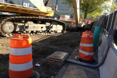
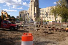
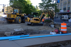
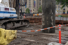
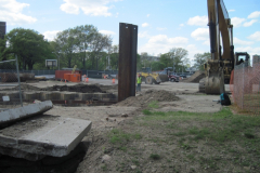
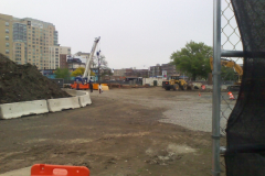
- At the end of this notice we have included some pictures that show the construction progress since we completed the first half of the Riverway Culvert and began active diversion of the Muddy River. We thought folks would be interested in seeing the work occurring behind the fence.
- If you have any questions, require additional information or would like to be added to the Project Contact List, please email the projectmailbox at MuddyRiver@usace.army.mil
May Traffic Patterns and Project Photos
Project Phase 1
(U.S. Army Corps of Engineers photos)
Muddy River rises March 14, 2010
(U.S. Army Corps of Engineers photos)


